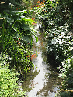
I decided to follow this stream because on another occasion I was a bit lost in Staines and in my lostness stumbled across a Heron in a ditch with a fairly large fish in its mouth. This was a couple hundred metres from the Staines railway station.
The label for Sweep's Ditch is displayed
directly to the south of Staines Road,
and to the north of Peyton Hook on the Thames
From that original high point (upstream is central Staines and its High Street, beyond which are the two large rivers famous confluence), I followed the ditch downstream as best I could. Right at the start I scared up some 6-inch fish, and a whole jumble of smaller sizes swimming in schools through the shallows. There is lots of cover under the various wetland plants that populate the stream bed.
A local stopped me as I was photographing near her house, asking me if I was from the council. I said no, but that I am also a local interested in bird, fish, and urban ecology. This seemed to satisfy here, though I think she still assumed I was from the council, as she proceeded to explain how a factory upstream turns the stream blue sometimes, and how the stream dries out.
Noting my disapproval for the above, I noted the current health of the stream and the size of the fish, and how I had seen a heron with a large fish in its mouth last year at this very point in the stream. She said, well it doesn't go very far.
It didn't, not on Budebury Road anyway. but to follow this watercourse for its entirety, I was forced to not only discover whole new parts of Staines I had not known about before, but to take a fairly convoluted path, with many backtracks.
GPS track of the Sweep's Ditch survey
Here is a photographic record of just about every sighting of the stream on its way to the Thames, starting from near Staines train station, and ending at Penton Hook Lock.


No comments:
Post a Comment